Park Introduction
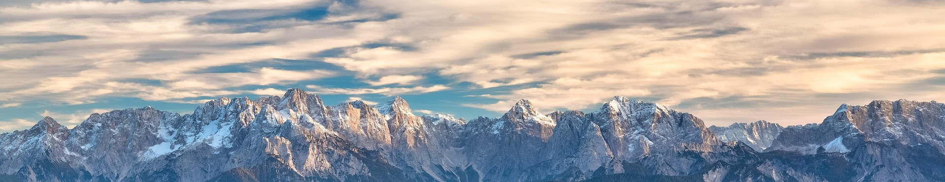
Welcome to the Park Introduction of GHNP (Great Himalayan National Park) — a UNESCO World Heritage Site located in the Banjar sub-division of Kullu district, Himachal Pradesh, in the far Western Himalayas.
Initially constituted in 1984, and formally notified as a national park in 1999, GHNP is a relatively recent addition to a network of protected areas in northern India and adjacent countries which increasingly provide protection to the Himalaya.
The Himalaya region is globally recognized as one of Conservation International’s 34 biodiversity hotspots. The Himalayan biodiversity hotspot contains not only the world’s highest mountain ranges and alpine ecosystems, but also lower-elevation temperate forests, subtropical forests, and grasslands. It spans 3,000 km east to west and 300–500 km north to south.
Hotspots are defined by factors such as high levels of endemism, rare and threatened species, and overall species richness. GHNP fully qualifies under these, being home to 832 floral and 386 faunal species, including the Himalayan blue poppy, western tragopan, and Himalayan tahr — all species of conservation priority.
The World Wide Fund for Nature (WWF) includes parts of the Himalaya in its Global 200 list of ecoregions, and GHNP lies within one such critical ecosystem. Constituted in 1984 and officially notified in 1999, GHNP is a protected area in Northern India and forms part of a growing network of conservation areas in the Indian Himalayas.

Bergenia in flowering in GHNP (click to enlarge)
In 1994, two major land-use changes occurred around GHNP, which covers 754.4 km²:
- A 5 km buffer zone on the park’s western edge was declared an ecozone spanning 265.6 km², home to around 2,300 households across 160 villages. Approximately 15,000 to 16,000 residents, largely dependent on forest-based livelihoods, have transitioned into sustainable income-generating activities such as basket making, vermicomposting, organic farming, medicinal plant cultivation, and ecotourism in Himachal Pradesh.
- The creation of the Sainj Wildlife Sanctuary (90 km²), surrounding the villages of Shagwar, Shakti, and Maror, and the establishment of the Tirthan Wildlife Sanctuary (61 km²) on GHNP’s southern edge. The Tirthan Valley is especially known for its untouched Himalayan landscapes and biodiversity hotspots.
In 2010, the Parvati River catchment (710 km²) to the park’s north was declared Khirganga National Park, enhancing the ecological corridor and contributing to species migration and habitat connectivity.
The boundaries of GHNP are also contiguous with other notable protected areas in Himachal Pradesh, including:
- Pin Valley National Park in the Trans-Himalaya range (675 km²)
- Rupi Bhabha Wildlife Sanctuary in the Sutlej watershed (503 km²)
- Kanawar Wildlife Sanctuary in the Parvati Valley (107.29 km²)

GHNP Boundaries
GHNP and its ecozone intersect with major ecological zones and biogeographic regions, such as:
-
The cold deserts of Central Asia
-
The humid lowlands of the Indian plains
-
The Indomalayan and Palearctic biogeographic realms
-
The Tibetan Plateau
-
The catchments of the Beas and Sutlej rivers, major tributaries of the Indus River
Although compact in area, the diverse altitudinal gradients and microclimates in GHNP allow it to sustain an unusually wide range of flora and fauna, characteristic of South-East Asian rainforests, the Siberian taiga, and Himalayan alpine meadows. Few national parks in India of similar size can claim such ecological diversity. Through this Park Introduction GHNP, visitors can gain deeper insights into the unique landscapes, flora, and fauna of the region.